Design Google Maps | Micro Graphs and Segments
Micro graphs and segments system design of Google Maps with a deep dive
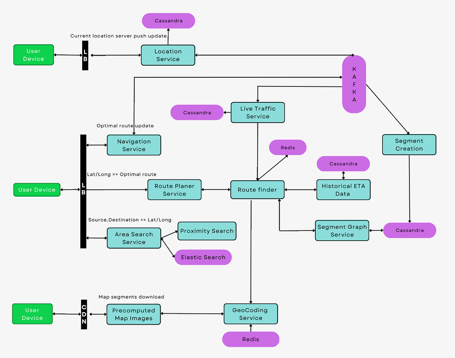
Google Maps, a hallmark of geospatial technology and software engineering, offers services ranging from simple map views and directions to more complex geolocation-based services. We'll dive into the high-level architecture of Google Maps, the concept of geohashing, representation of maps as graphs, and finally, algorithmic determination of the most optimal route from one point to another.
Geohashing
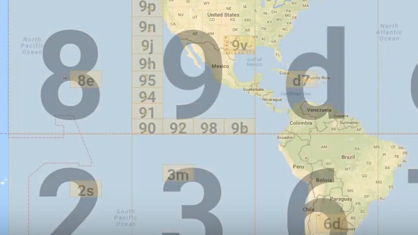
Geohashing is a method of encoding geographic coordinates (latitude and longitude) into a short string of letters and digits. It works by recursively dividing the world into smaller and smaller rectangles and then assigning a unique character sequence to each of these rectangles.
This technique has several benefits:
Efficiency: Short strings are easier to index and query.
Proximity: Geohashes that are geographically close tend to have prefixes in common, allowing for faster proximity searches.
Flexibility: The length of a geohash can be adjusted based on precision needs.
Maps as Graphs
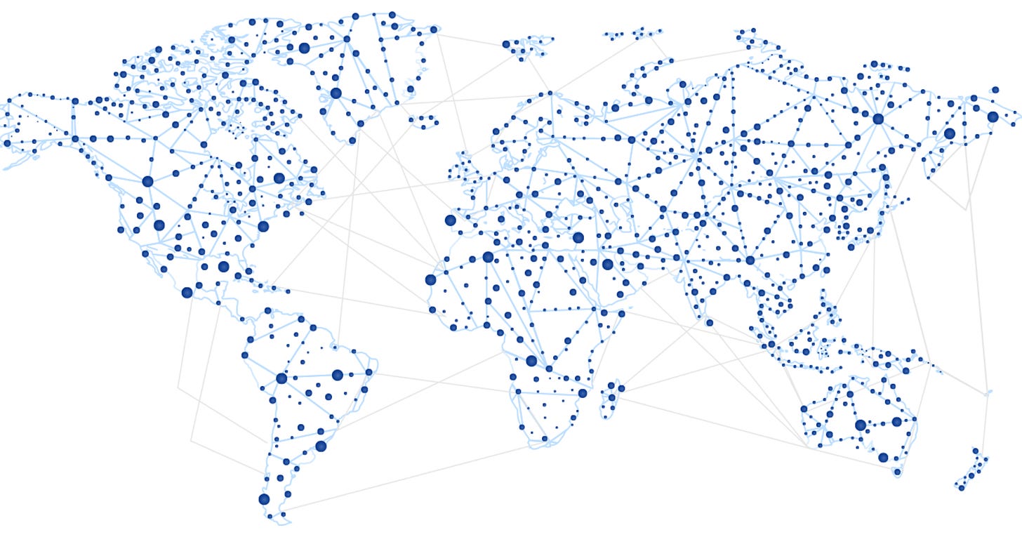
A map can be abstracted into a graph where intersections and endpoints of roads become nodes, and the roads themselves become edges. This simplifies the challenge of finding routes to the problem of finding paths in a graph.
Nodes: Represent intersections, landmarks, or endpoints.
Edges: Represent roads, pathways, or alleys connecting nodes. They can have weights corresponding to distance, time, or any other metric of interest.
Finding the Most Optimal Route from Point A to Point B
With the map represented as a graph, determining the best route is an algorithmic challenge. The Dijkstra’s algorithm and the A* search algorithm are popular methods:
Dijkstra’s Algorithm: This algorithm finds the shortest path from a starting node to all other nodes in the graph. It's both efficient and guarantees the shortest path.
A Search Algorithm*: This is a heuristic-based approach that uses the idea of cost from the start and estimated cost to the destination to prioritize which paths to explore. It's particularly useful when the entire graph is too large, as in real-world maps.
By applying these algorithms to the graph representation of the map, Google Maps can quickly determine and adjust the optimal route based on various factors like traffic, road closures, and more.
Here's a more detailed explanation 👇


